Public Lands Act, R.S.O.1990
Are you planning to conduct work along a shoreline?
The Ministry of Natural Resources and Forestry (MNRF) reminds landowners that a work permit may be required before working in the water or along your shoreline.
Instructions
Use this form if you intend to construct a new or expand an existing erosion control structure1 on shore lands2 along your waterfront property3. This form may be utilized to apply for work involving filling or dredging of shore lands for erosion control.
1 For the purpose of the work permitting process, an erosion control structure shall be considered as anything that is placed, or constructed in order to protect a shoreline from erosion. Examples of erosion control structures include gabion baskets, armour stone, groynes and retaining walls.
2 Shore lands are lands covered or seasonally inundated by the water of a lake, river, stream or pond.
3 Waterfront property means a parcel of land that has a boundary on a lake, river, stream or pond, or is separated from a lake, river, stream or pond only by, an unopened road allowance, or a strip of public lands that is not more than 30 metres in perpendicular width from the lake, river, stream or pond.
What is a Work Permit?
A work permit is issued under the authority of the Public Lands Act, R.S.O.1990 to authorize activities on public lands and shore lands. Public lands mean any lands under the control and management of the MNRF, including the beds of most lakes and rivers in Ontario. A Work Permit ensures that specific activities on public lands and shore lands have regard for the environment, other users and neighbouring landowners.
Timelines for Work Permit Reviews
The Ministry has a service standard of 21 business days for the review and issuance of work permits for erosion control structures. Note that the Ministry must assess and fulfill the duty to consult with Indigenous communities as well as review some structures for engineering requirements. This may extend review timelines.
If you are in doubt on whether a Work Permit is required; please contact your local ministry work centre.
Please submit this application by mail or email to your local ministry work centre.
Collection of Personal Information
Personal information on this form is collected under the authority of Section 13 of the Public Lands Act, R.S.O.1990 and Ontario Regulation 975 as amended, and the information will be used for the purposes of the Act and Regulations.
Questions about this should be directed your local ministry work centre.
Fields marked with an asterisk (*) are mandatory.
2. Application Description
5. Reference Map and Photos
Your application cannot be processed without including this information
Please attach a photo of shoreline where work is proposed to be undertaken. These will help better process your application.
Please attach a reference map to this application with large extent view of your property and the surrounding area. Standard reference map templates can be accessed using our “make a topographic map” tool online.
https://www.ontario.ca/page/topographic-maps - see map example below
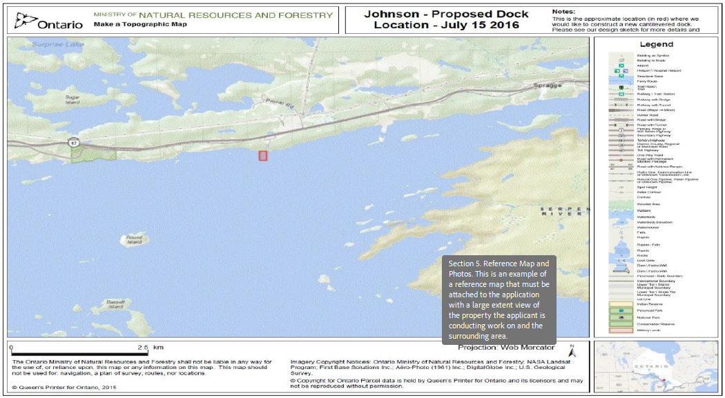
Note: This form and any attachments can not exceed 9MB in size in total.
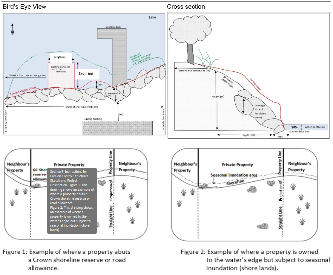
6. Instructions for Erosion Control Structures Sketch and Project Description
Please attach two sketches (bird's eye view and cross section). Include property lines, shoreland area that is seasonally inundated by water as well as the proposed structure dimensions. Please ensure that you sign and date each sketch submitted with your application. See examples below.